A trail tracing history and humanity across the peninsula
Coastal paths, rice paddies and fishing harbors connect all the way to the DMZ
An almost unrealistic ultra-long-distance route, yet more than 200 have completed it
Namparang Trail Course 83 in Gangjin: the friendship path of Dasan and Hyejang
Dosoram Hermitage on Dalmasan appears to float above a sea of clouds
At the southern tip, the Ttangkkeut Tower marks where Namparang ends and Seohaerang begins
![Dosoram Hermitage, a prime spot where both sunrise and sunset can be seen from the same place. [Korea Tourism Organization]](https://wimg.heraldcorp.com/news/cms/2026/06/09/news-p.v1.20260607.3454911d5ac44d29ad50f18e0c2d5121_P1.jpg)
The Korea Dulle-gil, a trail stretching some 4,500 kilometers around the Korean Peninsula, is a journey that traces every capillary of the nation's land.
The trail links broken coastal footpaths, rice paddy ridges and harbor embankments into a single continuous line reaching the demilitarized zone in the north, carrying within it the deep history and humanistic values the land has accumulated over centuries. Among its vast stretches, the sections of the Namparang Trail passing through Gangjin and Haenam — and the Seohaerang Trail where a new path begins — stand out as a symbolic passage where endings and beginnings interlock.
<style ref="s1">Depth of thought that exile could not confine</style>
The Korea Dulle-gil is an ultra-long-distance route that is daunting to attempt. Completing the full trail demands considerable time and expense, yet more than 200 people have walked every section — a testament to the steady stream of those drawn to it. The trail's value, however, does not lie in completion alone. Choosing a stretch and walking it slowly, as if in conversation with the earth beneath your feet, is more than enough to make the journey worthwhile.
Among its many sections, Namparang Trail Course 83 — roughly 17.5 kilometers long — passes through a place where one scholar's isolation and contemplation have accumulated in layers. The backbone of this course is Mandeoksan (408 meters), a mountain known for its wild tea trees. According to a local cultural tourism guide, the mountain is intimately tied to one man's life.
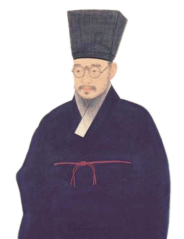
"From the top of Mandeoksan, you can see all of Gangjin Bay," the guide said. "It is a low mountain, only 400 meters, but wild tea trees have grown here in abundance since ancient times, so it was nicknamed 'Dasan,' meaning 'mountain of many tea trees.' That name became the pen name of Jeong Yak-yong, who lived on the slopes of Mandeoksan during his exile in Gangjin."
In the spring of 1805, the fourth year of his exile, Dasan Jeong Yak-yong visited Baengnyeonsa Temple for the first time when his movements became relatively unrestricted. There he met the head monk Hyejang. Each was struck by the other's profound scholarship, and an intellectual exchange began that transcended the divide between Confucian scholar and Buddhist monk. For the exile cast aside by the court and left with no way out, Hyejang became both an intellectual companion and a material and spiritual support.
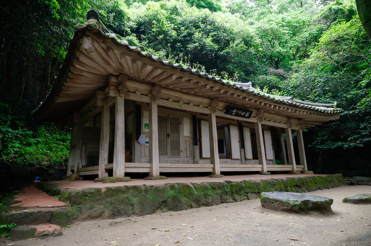
When Dasan moved to Dasanchogdang, a cottage near Baengnyeonsa, in 1808, the two met even more frequently. The roughly 800-meter mountain path connecting the two places is known today as the "Friendship Path of Dasan and Hyejang." One story holds that Hyejang would visit without notice at any hour, so Dasan kept his door open deep into the night.
During the 11 years Jeong spent at the unadorned Dasanchogdang, he wrote roughly 500 volumes, including "Mongminsimseo," "Gyeongse Yupyo" and "Heumheum Sinseo." Walking through the cottage today, the ease and elegance of the place make it hard to believe it was a site of exile. The space quietly proves that physical confinement could not imprison the depth of thought.
Leaving Gangjin and entering Haenam, Namparang Trail Course 90 begins — a route that sets out from Mihwangsa Temple on Dalmasan and runs all the way to the Ttangkkeut Tower at the southern tip of the peninsula. A detour along the way leads to Dosoram Hermitage, considered a prime spot where both sunrise and the West Sea sunset can be seen from the same place.
Dosoram was destroyed by retreating Japanese forces during the Jeongyu War and lay in ruins for some 400 years, with only its foundation stones remaining, before being restored in 2002. The story goes that a monk from Woljeongsa Temple on Odaesan had the same dream three nights in a row, then found this site he had never visited before and completed the building — including its decorative paintwork — in just 32 days.
The site was so rugged that neither vehicles nor helicopters could reach it. Builders overcame the challenge through prefabrication: timber was cut and painted at a lumber mill at the foot of the mountain, then assembled on site.
The hermitage is tiny — barely a single room — but jagged rock formations surround it like a stone fortress wall, giving it a striking presence. Standing in the small courtyard and facing the raw sea wind, the South Sea spreads out without obstruction. On days when sea fog or clouds roll in along the Dalmasan ridge, Dosoram appears to float above a sea of clouds, conjuring an almost otherworldly atmosphere. The dignity of a place that holds within its small frame both stillness and the narrative of devoted practice leaves a lasting impression.
<style ref="s2">A tower marking the peninsula's end — and a waypoint on the Korea Dulle-gil</style>
Ttangkkeut Village in Haenam, included in Namparang Trail Course 90, is regarded as a symbolic sacred site for those making a pilgrimage of the national land. No ground on the Korean Peninsula's mainland allows one to walk any further south. Viewed differently, this is also where the land begins — a place laden with meaning.
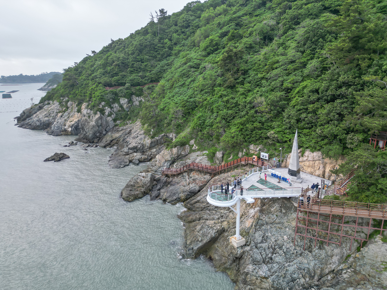
The southernmost point can be reached by monorail or on foot. A barrier-free deck path designed for those with limited mobility leads to a skywalk jutting straight out toward the sea, its floor made of transparent tempered glass through which the blue water is visible directly below. Each step delivers a vertiginous sense of height and visual openness that is at once thrilling and joyful.
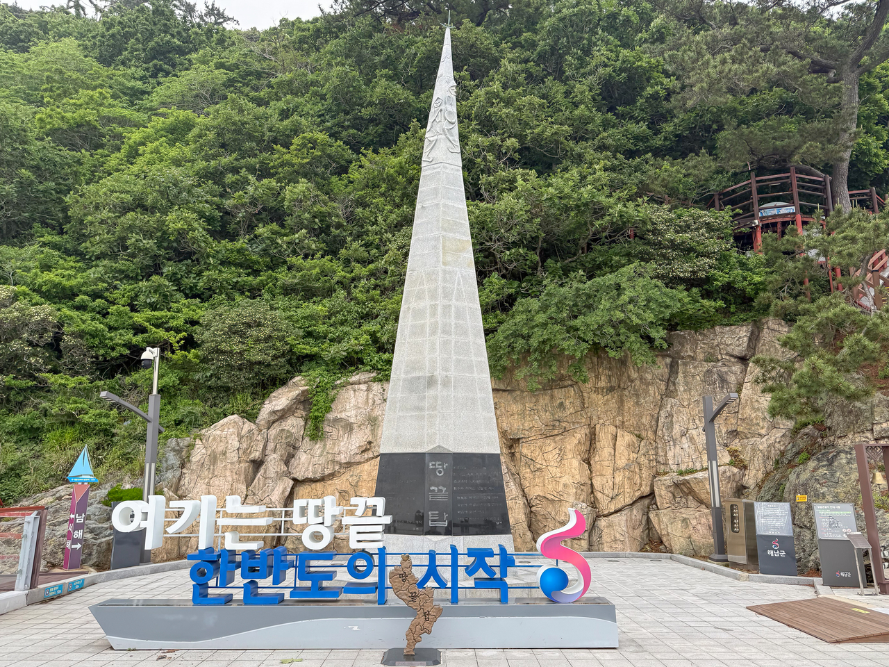
Beyond the skywalk stands the Ttangkkeut Tower — a 9-meter-tall triangular pyramid that announces arrival at the end of the Korean Peninsula. Within the context of the Korea Dulle-gil, it carries particular significance. Standing with the tower at the center and facing the sea, the jagged coastline curving to the left traces the South Sea territory the Namparang Trail has crossed, while the long horizon stretching to the right marks the West Sea where the Seohaerang Trail begins. The spot is accordingly a fine place to watch both sunrise and sunset.
The sea stretching endlessly before it knows no boundary, but it is here that the Korea Dulle-gil turns and begins heading north again. That is why the symbolism of this geographical turning point — and the sense of a cycle leading to a new beginning — feels most vivid at the land's end. In the way that every conclusion ultimately leads to another beginning, this trail closely mirrors the arc of a life.
<style ref="s3">'Is this really a public building?' — a hotel that merges with the horizon</style>
Heading north from the Ttangkkeut Tower and following Seohaerang Trail Course 14, walkers arrive at Oshiano Tourism Complex — a resort with a hotel, beachside campground and golf course. The Haenam126 Oshiano Hotel within the complex has been gaining a reputation by word of mouth as a place to recover from the fatigue of long-distance walking. Its design quality is high enough to have won an excellence award at the Ministry of Land, Infrastructure and Transport's Korea Public Architecture Awards, evoking the feel of a top-tier brand hotel — yet it is a public building operated by the Korea Tourism Organization.
"We get a lot of questions asking whether this is really a public institution building, and we take that as a great compliment," an official at the Korea Tourism Organization's Gwangju and South Jeolla Province branch said. "The occupancy rate is high because the price is reasonable relative to the quality of the facility."
All 120 rooms face the West Sea, offering unobstructed ocean views. The infinity pool has become a well-known photo spot. Designed with an overflow system, it creates the visual effect of the water's surface merging seamlessly with the West Sea horizon. Passenger ferries and car-carrier vessels traveling between Mokpo and Jeju pass in front of the hotel. Watching the lights of the ships from the infinity pool in the evening, the day's fatigue slowly dissolves.
<style ref="s4">Seohaerang Trail Course 18: reading Mokpo's modern history on foot</style>
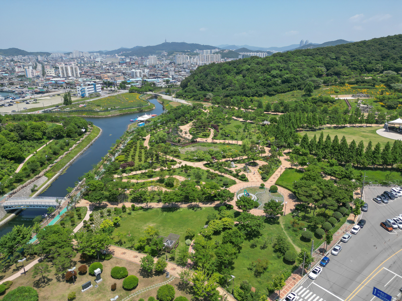
Leaving Oshiano and continuing along the Seohaerang Trail, walkers reach Mokpo. Course 18 is an 18.3-kilometer stretch that takes in Peace Square, Gatbawi Rock, Samhakdo Park, the Kim Dae-jung Nobel Peace Prize Memorial Hall, Mokpojin Historical Park and the Modern History and Culture Street. The salt-tinged harbor air, red-brick modern streetscapes and quiet mountain paths alternate to form a compressed walking tour through Korea's modern and contemporary history.
After passing through the alleys of the Modern History and Culture Street — which includes the first branch of the Mokpo Modern History Museum, originally built as a Japanese consulate — the trail turns back toward the sea. Walking along a strip of land connected to the mainland leads to Samhakdo Park, which holds the legend of three cranes that descended and became islands.
Cutting through the park, walkers reach a memorial hall dedicated to the life and peace philosophy of former President Kim Dae-jung, Korea's first Nobel Peace Prize laureate. In nearby Nanyeong Park, trees planted in memory of singer Lee Nan-young — who performed "Tears of Mokpo" — cast a quiet shade that invites walkers to pause and rest.
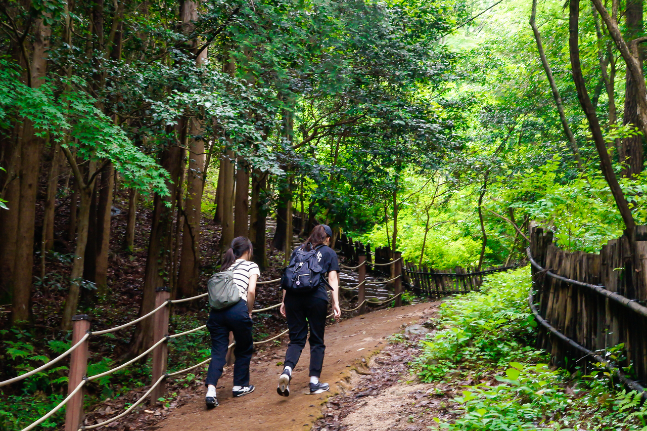
Along the way, several hikers wearing Korea Dulle-gil badges were spotted on the trail. One elderly walker, asked why he was walking such a long route, answered without much fuss: "I can't do the whole thing. Still, I want to go as far as I can."
That unhurried answer may be the closest anyone has come to capturing the essence of the Korea Dulle-gil. Not fixating on the grand full stop of completion, but simply moving forward step by step — that itself is already a complete purpose. When your gaze shifts from a distant goal to the ground beneath your feet and the world around you, the scenery and stories of the trail finally come into view. A slow walk in conversation with the earth becomes a way of stepping into the countless stories layered upon it — a vast classroom for encountering the time this land has passed through and the lives of the people who have flickered within it.
terry@heraldcorp.com