- Team uses unmanned surface vessel to remotely receive and record seismic signals, successfully demonstrating the technology along a 4-kilometer stretch off Pohang
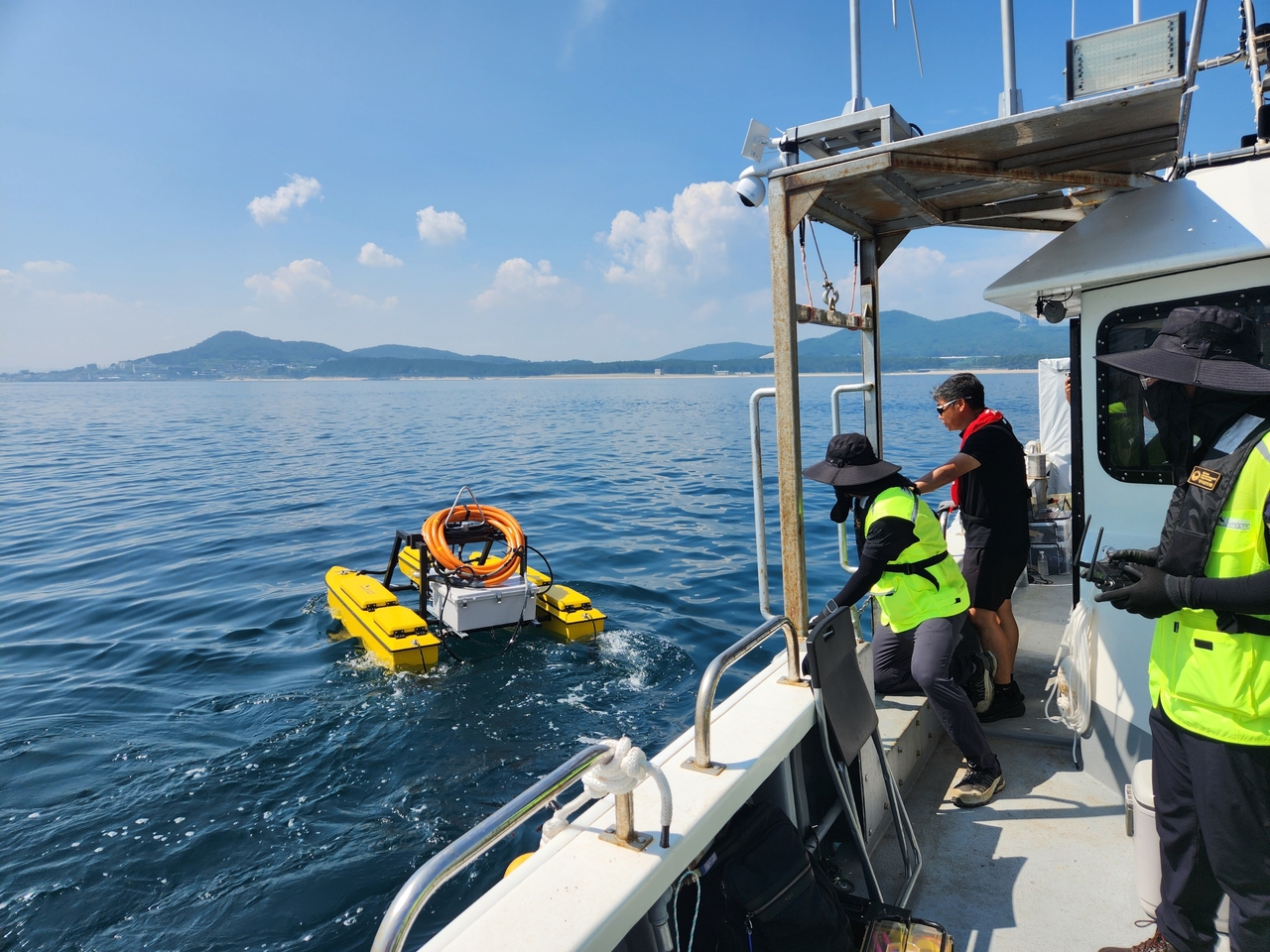
South Korean researchers have developed an unmanned seafloor survey technology capable of mapping geological structures more than 200 meters below the seabed — even in shallow coastal waters where large survey vessels cannot operate.
The Korea Institute of Geoscience and Mineral Resources announced Monday that a research team led by Senior Researcher Shin Jeong-gyun at its Pohang Geoscience and Mineral Resources Research Center, working jointly with the Korea Institute of Ocean Science and Technology (KIOST), had developed a coastal seismic survey technology using unmanned surface vessels (USVs) and successfully validated it in open-water trials off Pohang.
Marine seismic surveying works by generating artificial seismic waves and analyzing the refracted or reflected signals as they pass through subsurface layers, allowing researchers to map underground geological structures. The technique is used in foundational surveys for offshore resource exploration and maritime infrastructure projects such as offshore wind farms and undersea tunnels.
Conventional surveys typically rely on a single large vessel carrying both the seismic source and the receiving equipment. In shallow or nearshore coastal zones, however, vessel access is restricted and operating survey equipment poses additional challenges.
To overcome these limitations, the research team developed a new survey configuration that separates the two functions: a crewed vessel generates the seismic waves while a USV positioned at a distance receives and records the signals.
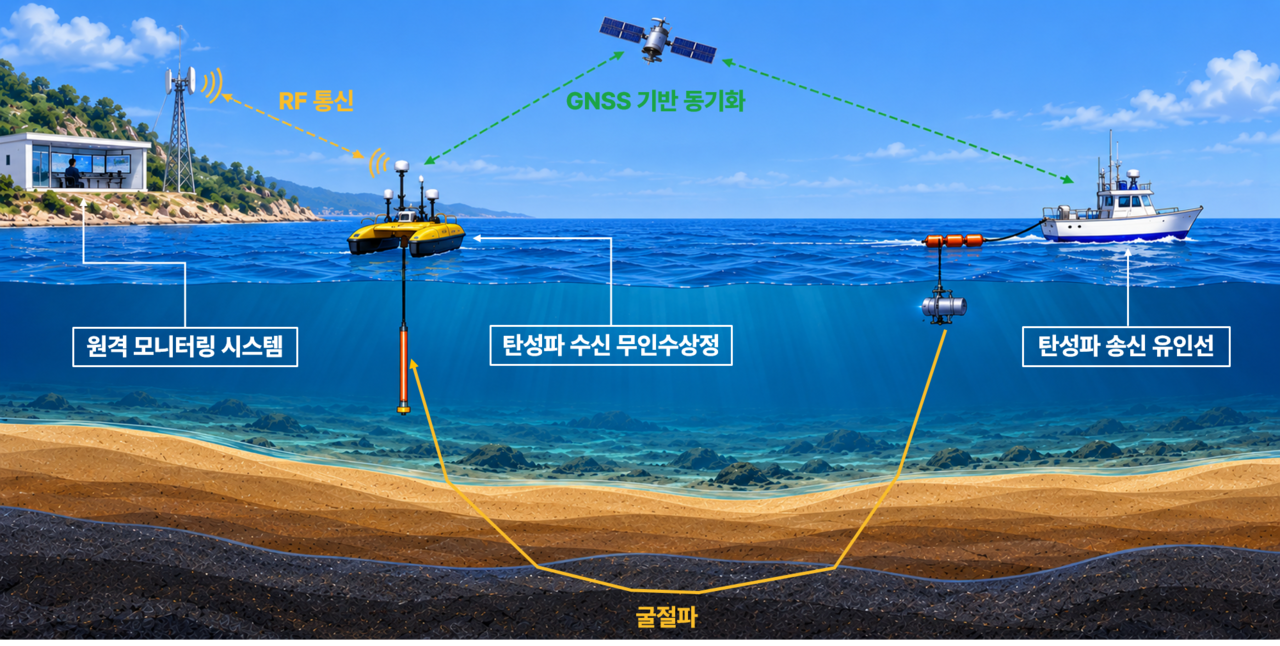
In this setup, a crewed vessel generates seismic waves while a remotely positioned USV receives and records the signals after they pass through the subsea layers. The approach extends survey coverage to coastal areas previously inaccessible to large vessels.
The team also developed a compact, low-power seismic data acquisition system in-house, designed to work within the limited space and power constraints of a USV. Integrating the seismic receiver, recording unit and wireless communications device, the system lets operators control equipment remotely and monitor data collection in real time.
To verify performance, the team set up a roughly 4-kilometer survey corridor in waters east of Hwajin Beach in Pohang, North Gyeongsang Province, and conducted field trials.
Moving the USV to five separate positions, the team collected seismic data at each point and successfully identified refracted wave signals that had traveled through subsea layers from about 2 kilometers away.
Applying a technique known as first-arrival travel-time tomography — which analyzes the time it takes seismic waves to first reach a receiver — the team produced velocity-structure images of P-waves to depths exceeding 200 meters below the seafloor.
In the shallower western portion of the survey area, the team identified a subsurface layer where P-waves traveled faster than in the surrounding geology. The results showed that data collected remotely by the USV alone is sufficient to analyze the geological structure beneath the seafloor.
The team plans to expand the technology to vertical cable seismic surveys and long-range reflection seismic surveys using USVs. It also intends to build a multi-vessel unmanned survey system capable of operating several USVs simultaneously, with the goal of automating marine seismic exploration.
"Marine seismic surveying has been relatively slow to transition to unmanned operations compared with other ocean survey fields," Shin said. "This research is significant in that it demonstrated the feasibility of unmanned surveying by applying automation incrementally — starting with the receiving end — to overcome the spatial limitations of conventional survey systems."
nbgkoo@heraldcorp.com