![Shops near Donghaksa temple in Banpo-myeon, Gongju, South Chungcheong Province, are flooded by monsoon rain on Thursday. [Gongju Fire Department]](https://wimg.heraldcorp.com/news/cms/2026/07/09/rcv.YNA.20260709.PYH2026070907940006300_P1.jpg)
Forecasters warned that very heavy rain — up to around 50 millimeters per hour — will again pound the Greater Seoul area and the inland areas of Gangwon Province from Thursday night, before a North Pacific high-pressure system moves in to bring a full-scale heat wave and tropical nights across the country.
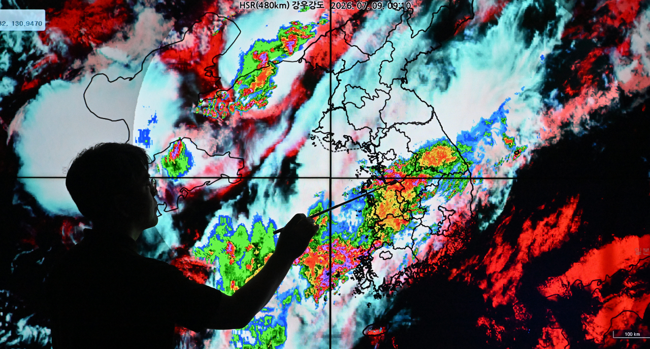
The Korea Meteorological Administration said at its regular briefing Thursday that intense rain will concentrate over the Greater Seoul area and the inland Gangwon region from Thursday night through Friday morning. Some parts of northern Greater Seoul and inland Gangwon could receive more than 150 mm in total.
The Chungcheong and Jeolla regions were already hit by downpours of around 80 mm per hour from Wednesday night, with cumulative rainfall exceeding 200 mm in some areas. The weather agency said the cause was a strengthening of the low-level jet stream as the gap narrowed between cold, dry air from the north and the North Pacific high to the south, funneling large amounts of moisture through a narrow corridor.
The ongoing rain may ease temporarily or pause in some areas during Thursday afternoon, but the agency stressed this does not mean the rain is over — it is only a brief lull.
The agency said cold, dry air from the northwest will push south again from Thursday night while a new band of rain clouds develops over the Yellow Sea, causing rainfall to intensify once more. However, the center of the heavy rain is expected to shift northward from the Chungcheong and Jeolla regions toward Greater Seoul and inland Gangwon.
Particularly intense rain of around 50 mm per hour is forecast for the Greater Seoul area and Gangwon Province between Thursday night and early Friday morning.
The agency urged residents to take extra precautions against flooding in low-lying areas, river overflow, landslides and mudflows, given that the ground is already saturated from earlier rainfall. In border areas near North Korea, where heavy rain is also expected, the risk of accidents from rising river levels and fast-moving currents is expected to increase.
Nationwide heat wave to follow heavy rains
Once the heavy rain passes, conditions are expected to shift quickly into midsummer mode. A "double high-pressure" structure — with the North Pacific high covering the Korean Peninsula and the Tibetan high extending overhead — is forecast to bring a nationwide heat wave.
Heat wave advisories currently in effect for the Gyeongsang region are expected to expand to central regions from Saturday and then spread to most of the country. Sustained southwesterly winds carrying hot, humid air will push the heat index higher, and temperatures are expected to remain elevated overnight, with the number of areas experiencing tropical nights set to grow.
The agency said, however, that a temporary lull in monsoon rain does not mean the rainy season is over. From Saturday through early next week, the stationary front will remain north of the Korean Peninsula and monsoon rain will pause briefly, but localized showers are possible inland due to strong sunshine and high temperatures.
From the middle of next week, atmospheric volatility is expected to increase as cold air from the north interacts with a potential tropical disturbance developing in waters east of the Philippines.
The agency said rain could return nationwide around Wednesday to Thursday of next week, but cautioned that the position and intensity of the stationary front remain highly uncertain and urged the public to check the latest forecasts.
Meanwhile, Typhoon Bavi, the ninth named storm of the season, is currently moving northward in the northwestern Pacific and is expected to pass north of Taiwan before heading into mainland China, with no direct impact on South Korea anticipated. However, the agency warned that swells generated as the typhoon moves toward China could produce rough waves along the Jeju coast and the southern coast, and urged caution against accidents near shorelines.
newday@heraldcorp.com